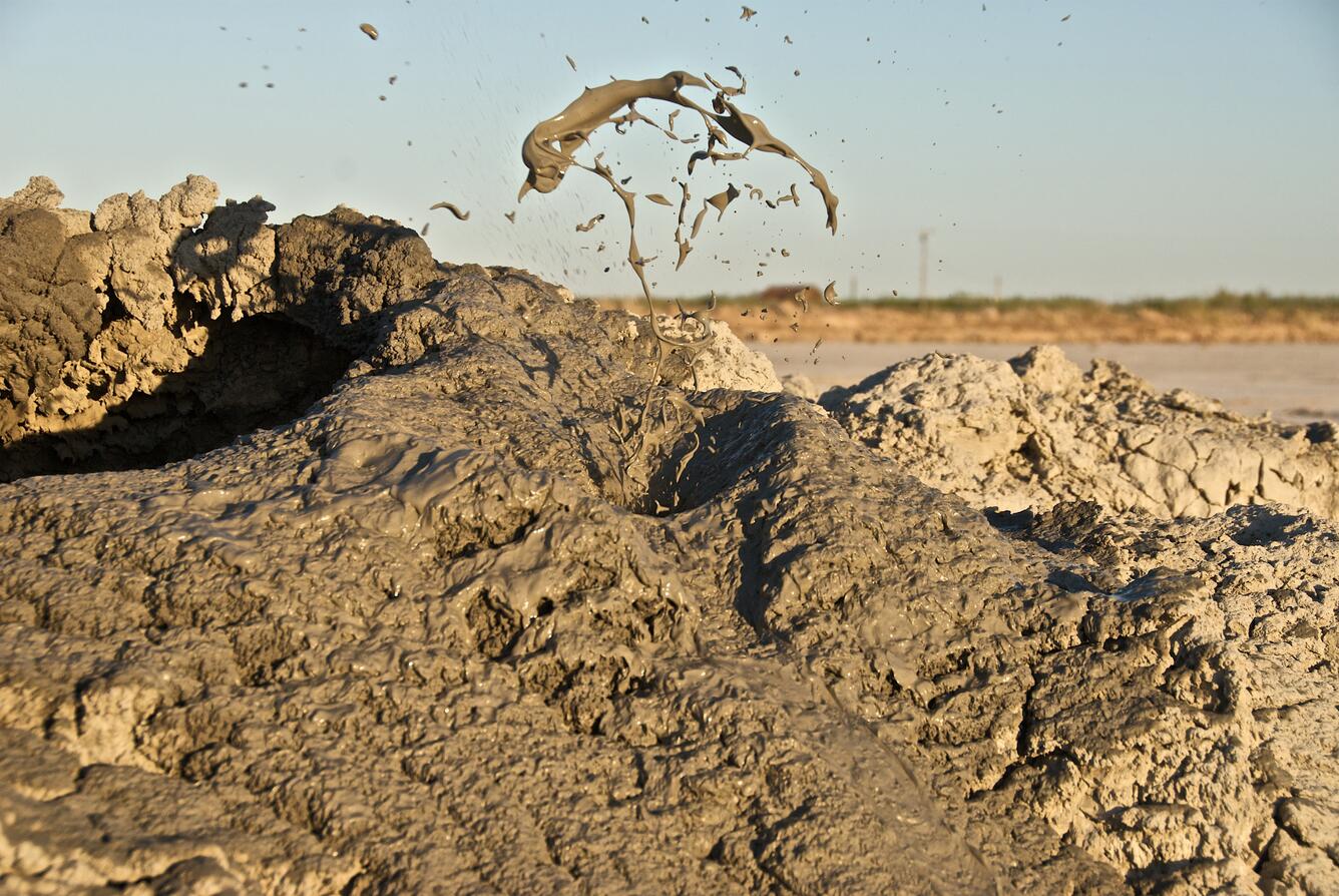
Water and gasses bubbling up to the surface can mix with sediment to form what are known as mud volcanoes. Unlike igneous volcanoes, mud volcanoes don’t produce lava flows. Underground pressure pushes natural gases to the Earth’s surface which get mixed along with the way with sediment and mineral deposits. The mud mixture gets pushed upwards through fissures or faults where the slurry forms structures on the Earth’s surface. When these structures form underwater they are known as submarine mud volcanoes.
While not always related to seismic activity, mud volcanoes often form near areas where the Earth’s crust has cracked, such as subduction zones and sideways-slipping (lateral) faults.
Size of mud volcanoes
Mud volcanoes are relatively small compared to igneous volcanoes. Mud volcanoes vary in size from small mounds just a few meters across to large structures several kilometers wide.
Shapes of mud volcanoes
Mud volcanoes can form different shapes depending on the ratio of water to sediment, how active it is, and the size of the underground channel transporting mud to the surface. For example, cone-shaped mud volcanoes usually form when thicker, less watery mud slowly builds up around a central vent over time. If the mud has more water, it spreads out more easily and creates flatter, plateau-like mud volcanoes (also known as mud pies).
Mud volcanoes versus mud pots
Mud volcanoes and mud pots may look alike, but they form in very different ways. Mud pots, like those found in California’s geothermal areas such as Lassen and the Salton Buttes, are hot features driven by underground volcanic heat. Mud pots bubble with a mix of steam, gases, and acidic water that breaks down surrounding rock into mud.
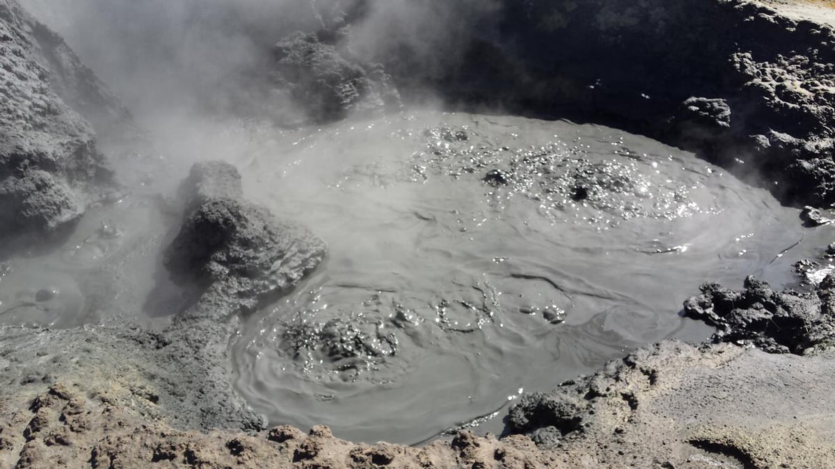
Mud volcanoes are cooler and form when pressurized mud and gas, most commonly methane and carbon dioxide, rise through faults to the Earth’s surface. Unlike mud pots, mud volcanoes do not always formed as a result of volcanic heat.
Mapping submarine mud volcanoes
Mud volcanoes (MVs) can pose risks to underwater structures like oil rigs, pipelines, communication cables, and wind farms. Mud volcano eruptions often release large amounts of mud and methane gas into the ocean and atmosphere. Research has estimated that mud volcanoes on land and in shallow water release between 2.2 and 6 million tons of methane into the atmosphere each year.
Because of these risks and their impact on the environment, it’s important to understand where mud volcanoes are located around the world. Researchers recently mapped 700 submarine mud volcanoes located in shallow seas. The “Global Inventory of Submarine Mud Volcanoes” contains information where these mud volcanoes are located and their shape. This new database includes both published data (like location, height, diameter, water depth, and slope) and additional information calculated by the researchers (such as estimated location, perimeter, area, volume, and shape ratios).
The inventory of shallow sea mud volcanoes almost triples the existing inventory of mud volcano locations and adds in additional attribute information for each feature. The only previous global database of underwater mud volcanoes was published in 2015 and contained location information for 258 features. Size, shape, and slope for 700 shallow sea mud volcanoes was compiled for the 2025 study. The GIS data set is available as a KMZ file.
The study:
Napoli, S., Spatola, D., Casalbore, D., Lombardo, L., Tanyas, H., & Chiocci, F. L. (2025). Comprehensive global inventory of submarine mud volcanoes. Scientific Data, 12(1), 382. DOI: /10.1038/s41597-025-04726-1